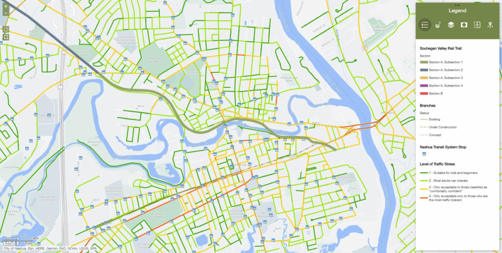
Browse the interactive route map of the proposed Souhegan Valley Rail Trail. Included in the map you’ll find the ability to toggle through relevant data pertaining to the route, the Souhegan Valley, and the Hillsborough Branch Rail Line. Opening the interactive route map will open a new tab in your browser.
Additional mapping
PDF maps are also available for the route. Feel free to download and share our maps!
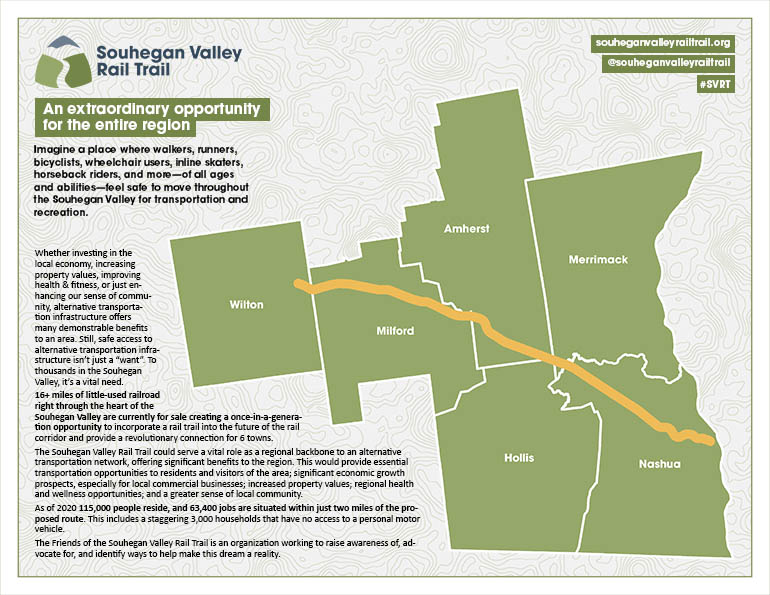
A brief summary of the Souhegan Valley Rail Trail initiative as well as a graphic depicting a simple version of the route
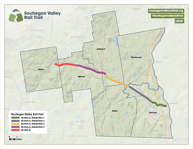
GIS Maps of the entire proposed route, as well as every individual section of the proposed route
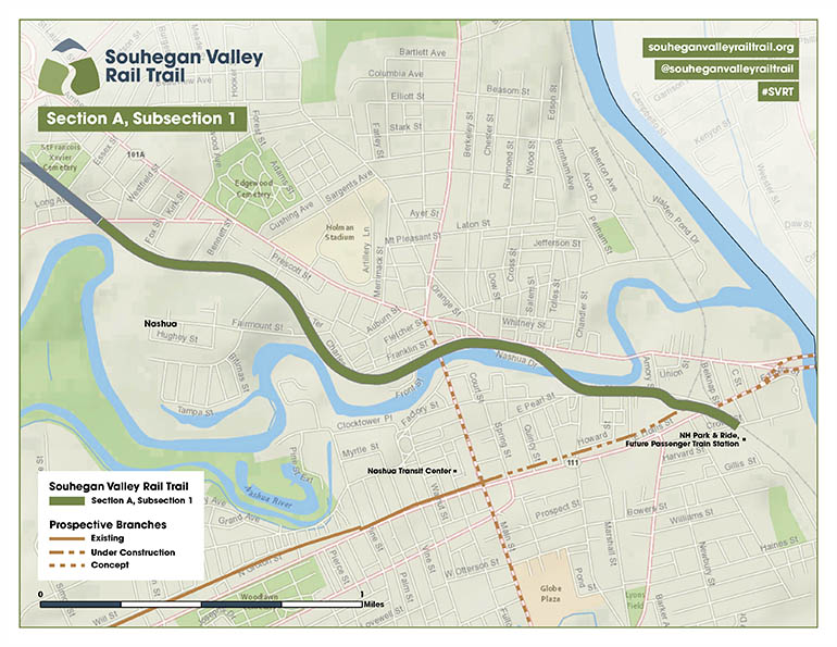
Section A, Subsection 1 spans from Crown Street in East Nashua to Broad Street in Nashua. This segment is entirely within the city limits of Nashua.
Section A, Subsection 2 spans from Broad Street in Nashua to Northwest Boulevard in Nashua. This segment is entirely within the city limits of Nashua.
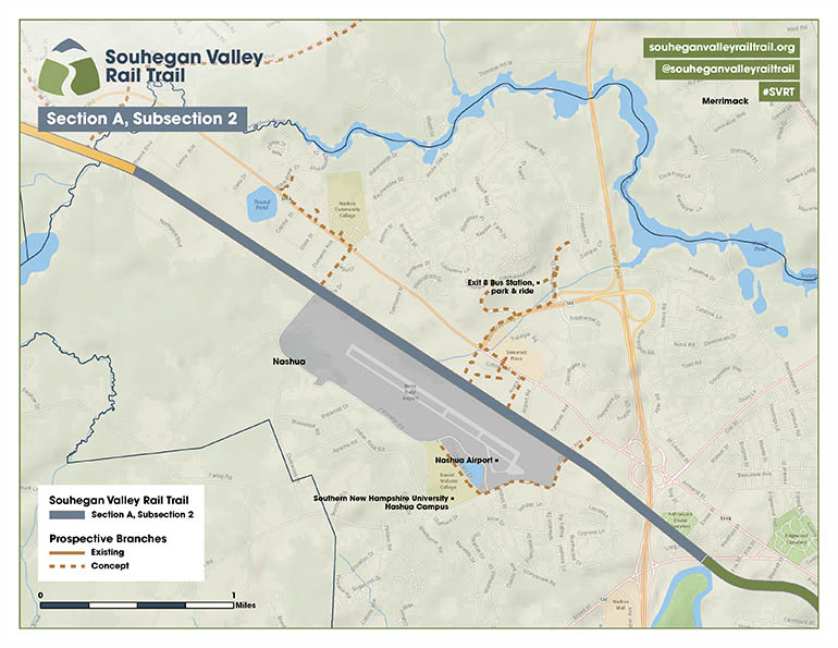
Section A, Subsection 2 spans from Northwest Boulevard in Nashua to NH 122 in Amherst. This segment serves Nashua, Merrimack, Hollis, and Amherst.
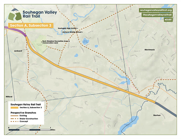
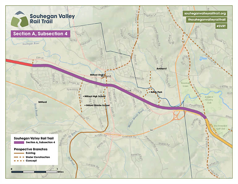
Section A, Subsection 4 spans from NH 122 in Amherst to Westchester Drive in Milford. This segment serves Amherst and Milford.
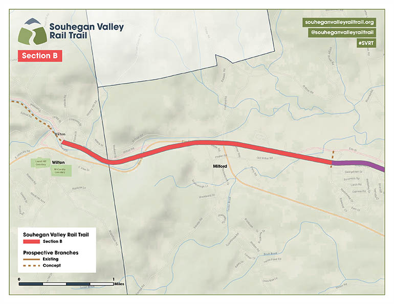
Section B spans from Westchester Drive in Milford to Wilton Center. This segment serves West Milford and Wilton.
White paper
In order to assess the need for, and viability of the Souhegan Valley Rail Trail as a concept, the Nashua Complete Streets Advisory Committee developed a comprehensive corridor profile. Within this document are many important considerations which provide a thorough description of the project, including:
a detailed analysis of existing conditions in the Souhegan Valley and the NH 101A corridor,
the status of the Hillsborough Branch Rail Line and its economic viability in the future,
some of the various benefits from which the Souhegan Valley could stand to benefit by adding an alternative transportation corridor,
recommended geometric design for the proposed rail trail, including assessments and suggested treatments for every crossing,
several connection opportunities for how the proposed rail trail can branch into the several communities through which it would run, and
many more details that paint a clear picture of how the Souhegan Valley would benefit from this project.
Gallery
Where the Hillsborough Branch crosses NH 13 in Milford
Where the Hillsborough Branch crosses West Street in Milford
Where the Hillsborough Branch crosses Main Street in Nashua